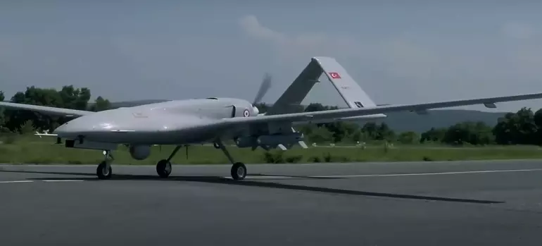
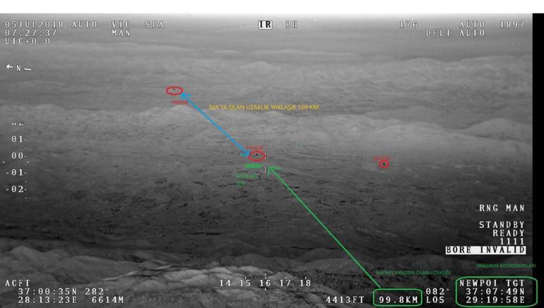
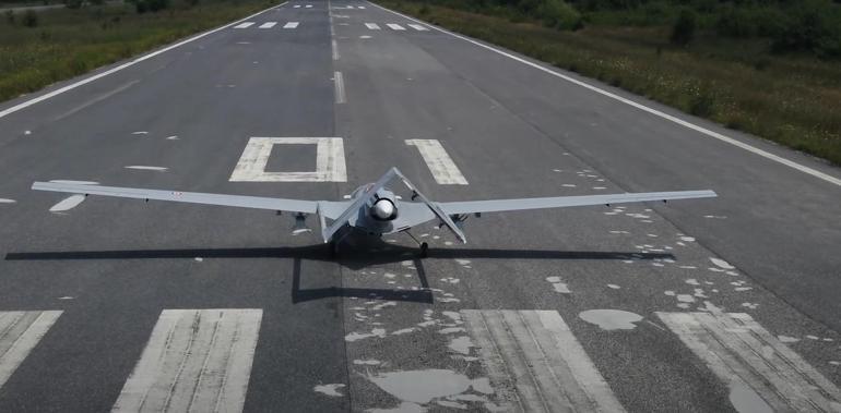
The 14 Bayraktar TB2 Unmanned Aerial Vehicles (UAVs) within the General Directorate of Forestry (OGM) are scanning the air 24/7 in the most risky areas in terms of fire. Thanks to UAVs that can detect 1 square meter of heat energy from a distance of 100 kilometers thanks to thermal cameras, the first response time to forest fires has decreased from 40 minutes to 10 minutes.
OGM, affiliated to the Ministry of Agriculture and Forestry, included 1 Bayraktar TB2 UAV in 2020 in order to intervene faster in forest fires. With the addition of new ones to the inventory, 14 UAVs are currently scanning the air 24/7 in the most risky areas in terms of fire.
Domestically and nationally produced Bayraktar TB2 UAVs can detect 1 square meter of heat energy from a distance of 100 kilometers thanks to thermal cameras. A UAV can scan 600 to 800 thousand hectares of land instantly and 3 to 3.5 million hectares of land within a minute. The images transmitted by UAVs, which can take off and land horizontally and vertically in difficult terrain conditions, are monitored second by second from the Fire Management Center of OGM in Ankara. Fires detected by UAVs are extinguished before they spread as a result of the rapid intervention of the teams in the field with the guidance of the center. Thanks to UAVs, the first response time to a fire has decreased from 40 minutes to 10 minutes.
‘WE ARE ONE OF THE 2 COUNTRIES USING DRONES’
Bekir Karacabey, Director General of Forestry, said that Turkey is one of the two countries in the world that use UAVs to monitor forests and manage forest fires, while the other is the USA. Karacabey said that with the effects of climate change, the impact, number and intensity of forest fires will increase, and that they have adapted their capacities according to this new situation. Karacabey said, “While we started using UAVs with 1 UAV in 2020, today we use 14 UAVs in forest surveillance and fire management.
Of these 14 UAVs, 12 are UAVs in our own inventory. Thanks to their features, these vehicles are used in fire surveillance and detection activities, while continuously monitoring forest areas with surveillance cameras and thermal imaging systems, and detecting possible fires at an early stage. Thus, fires can be controlled quickly and intervention teams can be directed to the area faster. With the IR feature in the cameras on the UAV, situations that may occur in fire areas are also detected and new fires are prevented.”
‘OUR TEAMS INTERVENE QUICKLY’
Emphasizing that the images transmitted by UAVs are instantly monitored from the Fire Management Center, Karacabey said, “This center is equipped with the best technology. It is a 7-24 active center. Our forests are monitored 24/7 from here. We have 776 fire watch towers in different parts of our forests, especially on high hills, on hills dominating the dominant terrain. 184 of these towers are also equipped with cameras.
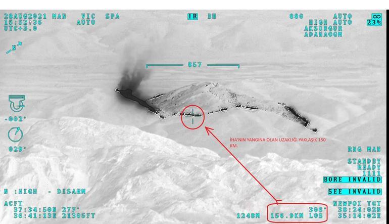
And the images of those cameras are monitored from this center. The images of our UAVs are instantly monitored from here. Not only our UAVs or towers have cameras. At the same time, some of our vehicles and the helicopters we use for firefighting also have cameras underneath them. We can monitor those cameras from here and manage them at the same time. These images flow here. With the directions we make from here, our teams in the field quickly intervene in the fire.”
Karacabey said that in addition to 14 UAVs, 105 helicopters and 26 aircrafts, a total of 145 aircraft were used in the fight against forest fires this year.


